The Story
Single-Sided Travel & Terrain Map | Scale: 1:750,000
Size: 1000 mm x 930 mm | Comprehensive Place Name Index
Order-on-Demand – Please Allow 10 Working Days for Delivery
🏔️ Navigate the Roof of the World with Precision and Clarity
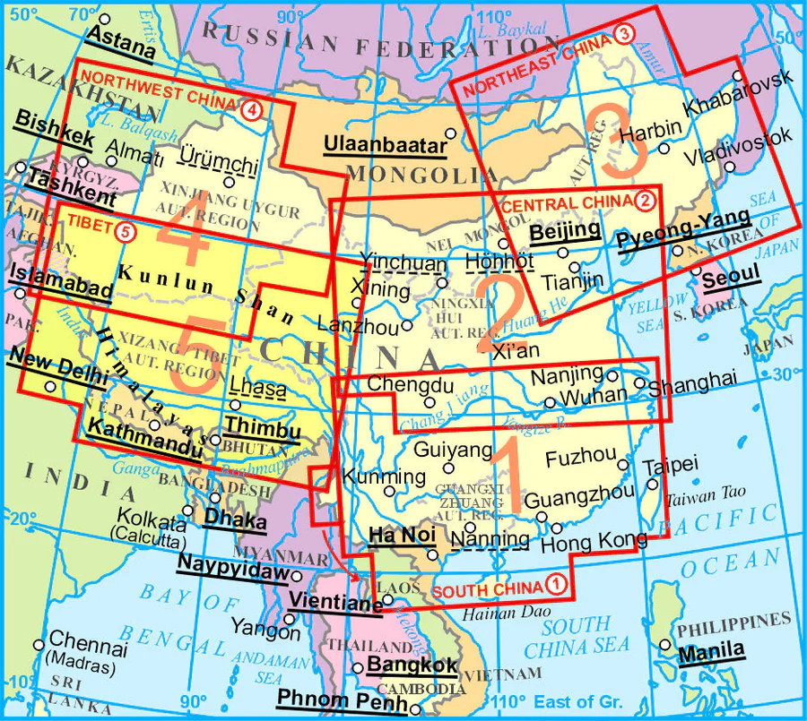
Uncover the majestic highlands, sacred monasteries, and remote roads of Tibet with this beautifully rendered folded map by Gizi Maps. Designed for travellers, explorers, and scholars alike, this single-sided topographic map at a practical 1:750,000 scale presents Tibet in clear and stunning detail—ideal for route planning, geographic reference, or simply admiring the vastness of this elevated and culturally rich region.
Whether you’re charting a journey across the Tibetan Plateau, visiting Lhasa, or exploring pilgrimage routes and mountain passes, this map offers a rare and valuable cartographic guide.
🧭 Key Features
✅ Full Regional Coverage on One Sheet
-
Entire Tibet Autonomous Region shown on a single map
-
Features key cities and regions such as Lhasa, Shigatse, Mount Kailash, and Lake Namtso
-
Borders with Nepal, India, Bhutan, and China clearly delineated
✅ Accurate Road & Terrain Detail
-
Clearly marked road network, including major highways, secondary roads, and remote tracks
-
Distances between key points shown for trip planning
-
Useful for overlanders, 4WD travellers, cyclists, and long-distance trekkers
✅ Elevation & Relief Shading
-
Colour shading brings the dramatic Himalayan terrain to life
-
Highlights valleys, rivers, mountain ranges, and elevation variations across the plateau
✅ Tourist Sites & Services
-
Denotes locations of cultural and historical significance including:
-
🏯 Monasteries
-
🕍 Temples and pilgrimage destinations
-
🏞️ National parks and scenic areas
-
-
Also marks accommodations, travel services, and transit hubs
✅ Comprehensive Place Name Index
-
Extensive list of cities, towns, and geographic features
-
Useful for quick referencing, cross-checking routes, and educational purposes
📐 Specifications at a Glance
| Feature | Details |
|---|---|
| Map Type | Single-sided folded travel & terrain map |
| Publisher | Gizi Maps |
| Scale | 1:750,000 |
| Size (Unfolded) | 1000 mm x 930 mm (approx. 39.4" x 36.6") |
| Topography | Colour-shaded elevation and relief features |
| Place Name Index | Included |
| Tourist Symbols | Yes – temples, monasteries, parks, services |
| Language | English (legend and place names) |
| Format | Folded map |
| Material | High-quality paper |
👥 Who Is This Map For?
-
🚗 Overlanders and self-drivers travelling across Tibet’s vast landscapes
-
🥾 Trekking and expedition groups navigating high-altitude trails and sacred routes
-
🕊️ Pilgrims and spiritual travellers visiting cultural and religious sites
-
📚 Students and researchers focused on Central Asian geography, history, and politics
-
🗺️ Map collectors looking for a rare, detailed representation of a unique region
🕒 Ordered on Demand – Please Allow Extra Time for Delivery
📦 Please note: This map is custom-ordered. Kindly allow up to 10 working days for processing and delivery.
🛒 Add the Gizi Tibet Folded Map to Your Cart Today
From sacred lakes to sky-high highways, this map is your trusted companion for exploring one of the world’s most remote and remarkable regions.
Details & Craftsmanship
Every detail has been carefully considered to bring you the perfect product.

Details & Craftsmanship
Every detail has been carefully considered to bring you the perfect product.

Details & Craftsmanship
Every detail has been carefully considered to bring you the perfect product.

Details & Craftsmanship
Every detail has been carefully considered to bring you the perfect product.
Description
Single-Sided Travel & Terrain Map | Scale: 1:750,000
Size: 1000 mm x 930 mm | Comprehensive Place Name Index
Order-on-Demand – Please Allow 10 Working Days for Delivery
🏔️ Navigate the Roof of the World with Precision and Clarity
Uncover the majestic highlands, sacred monasteries, and remote roads of Tibet with this beautifully rendered folded map by Gizi Maps. Designed for travellers, explorers, and scholars alike, this single-sided topographic map at a practical 1:750,000 scale presents Tibet in clear and stunning detail—ideal for route planning, geographic reference, or simply admiring the vastness of this elevated and culturally rich region.
Whether you’re charting a journey across the Tibetan Plateau, visiting Lhasa, or exploring pilgrimage routes and mountain passes, this map offers a rare and valuable cartographic guide.
🧭 Key Features
✅ Full Regional Coverage on One Sheet
-
Entire Tibet Autonomous Region shown on a single map
-
Features key cities and regions such as Lhasa, Shigatse, Mount Kailash, and Lake Namtso
-
Borders with Nepal, India, Bhutan, and China clearly delineated
✅ Accurate Road & Terrain Detail
-
Clearly marked road network, including major highways, secondary roads, and remote tracks
-
Distances between key points shown for trip planning
-
Useful for overlanders, 4WD travellers, cyclists, and long-distance trekkers
✅ Elevation & Relief Shading
-
Colour shading brings the dramatic Himalayan terrain to life
-
Highlights valleys, rivers, mountain ranges, and elevation variations across the plateau
✅ Tourist Sites & Services
-
Denotes locations of cultural and historical significance including:
-
🏯 Monasteries
-
🕍 Temples and pilgrimage destinations
-
🏞️ National parks and scenic areas
-
-
Also marks accommodations, travel services, and transit hubs
✅ Comprehensive Place Name Index
-
Extensive list of cities, towns, and geographic features
-
Useful for quick referencing, cross-checking routes, and educational purposes
📐 Specifications at a Glance
| Feature | Details |
|---|---|
| Map Type | Single-sided folded travel & terrain map |
| Publisher | Gizi Maps |
| Scale | 1:750,000 |
| Size (Unfolded) | 1000 mm x 930 mm (approx. 39.4" x 36.6") |
| Topography | Colour-shaded elevation and relief features |
| Place Name Index | Included |
| Tourist Symbols | Yes – temples, monasteries, parks, services |
| Language | English (legend and place names) |
| Format | Folded map |
| Material | High-quality paper |
👥 Who Is This Map For?
-
🚗 Overlanders and self-drivers travelling across Tibet’s vast landscapes
-
🥾 Trekking and expedition groups navigating high-altitude trails and sacred routes
-
🕊️ Pilgrims and spiritual travellers visiting cultural and religious sites
-
📚 Students and researchers focused on Central Asian geography, history, and politics
-
🗺️ Map collectors looking for a rare, detailed representation of a unique region
🕒 Ordered on Demand – Please Allow Extra Time for Delivery
📦 Please note: This map is custom-ordered. Kindly allow up to 10 working days for processing and delivery.
🛒 Add the Gizi Tibet Folded Map to Your Cart Today
From sacred lakes to sky-high highways, this map is your trusted companion for exploring one of the world’s most remote and remarkable regions.