The Story
🏜️ Simpson Desert Map – Westprint Heritage Series
The definitive map and trip-planning tool for navigating Australia’s most iconic desert crossing
🔍 Overview
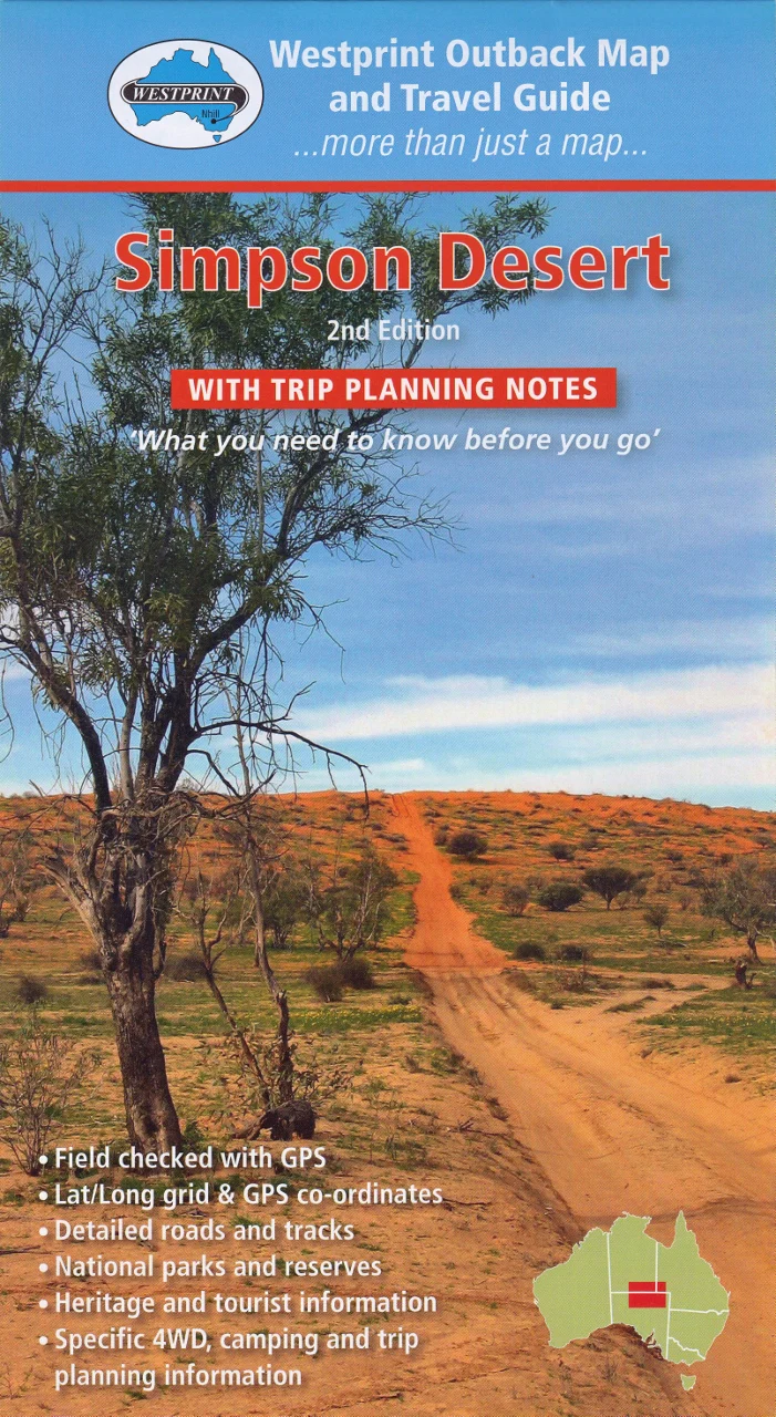
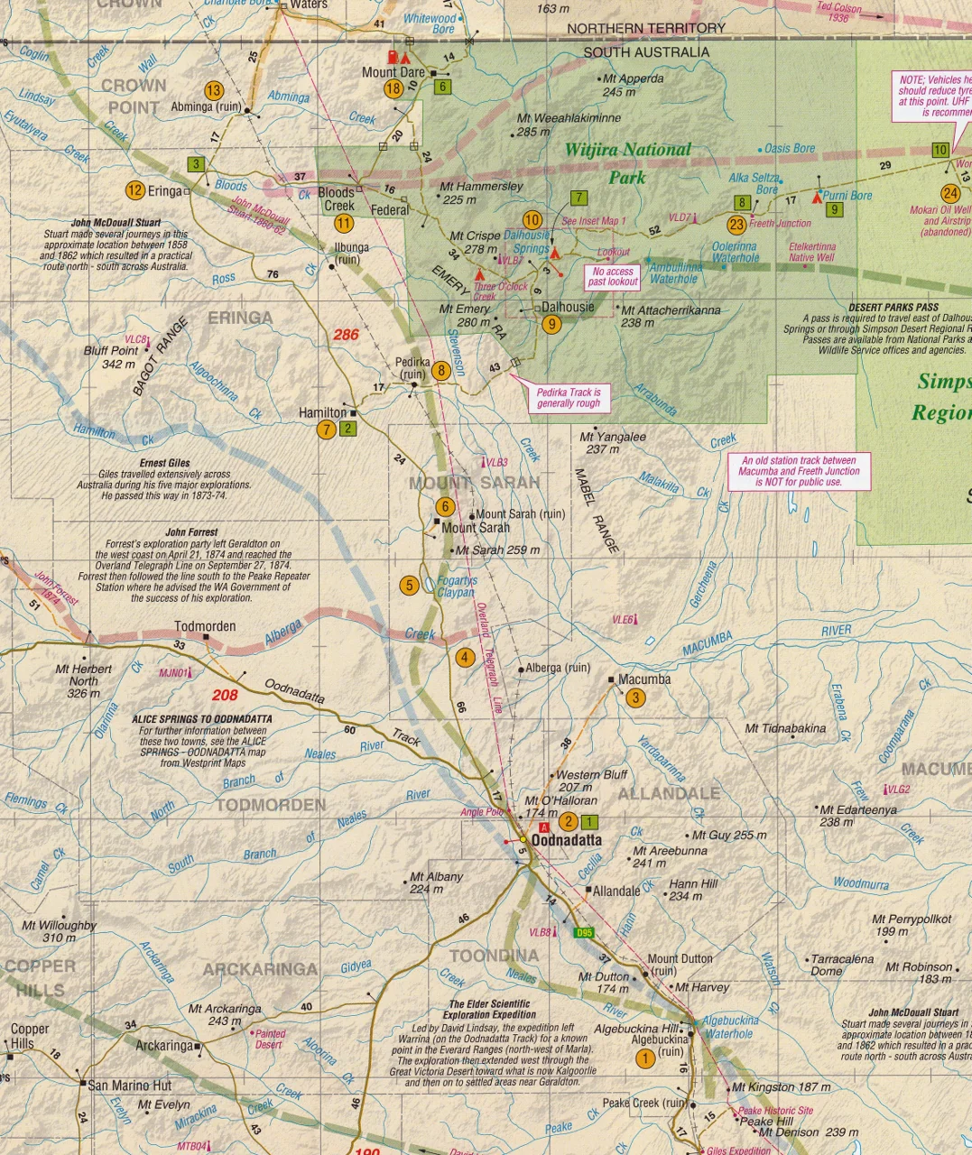
The Simpson Desert Map by Westprint is a purpose-built, richly detailed resource designed to help adventurers plan, navigate, and explore one of the most remote and awe-inspiring environments in the world — the Simpson Desert. Known for its towering red sand dunes, salt pans, and isolated beauty, the Simpson is a challenge even for experienced 4WD enthusiasts. This map provides the precision, context, and insights you need to travel safely and confidently through this spectacular region.
Whether you're preparing for a full desert crossing via the French Line, camping at Dalhousie Springs, or seeking out historic sites like Poeppel Corner, this two-sided map delivers both detailed topographic coverage and essential travel intelligence.
🗺️ Map Format & Features
Dual-Sided Design for Maximum Utility
Side A – Full Colour Topographic Map
-
Scale: 1:1,000,000 – ideal for wide-ranging route planning
-
Lat/Long Grid & GPS Coordinates throughout
-
Coverage includes:
-
French Line, Rig Road, WAA Line
-
Knolls Track, QAA Line, Hay River Track
-
Purni Bore, Dalhousie Springs, Poeppel Corner
-
Eyre Creek, Mt Dare, Birdsville
-
-
Marked fuel points, campgrounds, natural landmarks, and historic features
-
All major and minor 4WD tracks with intermediate distances clearly marked
-
Elevation shading and dune markings to help assess terrain and difficulty
Side B – Planning Guide & Track Notes
-
Detailed notes on over 60 points of interest, indexed to the map
-
Historical notes on early exploration, especially Burke & Wills and European surveying
-
Track classifications, suggested routes, and insider driving tips
-
Information on:
-
Vehicle prep
-
Fuel and water requirements
-
Safety and emergency guidelines
-
Weather and seasonal access
-
Camping etiquette and Leave No Trace principles
-
🧭 Coverage Highlights
| Region / Feature | Included? |
|---|---|
| Dalhousie Springs | ✅ |
| French Line | ✅ |
| QAA Line & Eyre Creek | ✅ |
| WAA Line & Rig Road | ✅ |
| Knolls Track | ✅ |
| Hay River Track (northern extension) | ✅ |
| Purni Bore | ✅ |
| Poeppel Corner | ✅ |
| Mt Dare, Birdsville, Oodnadatta Access Routes | ✅ |
🛠️ Practical Tools for Travellers
-
✅ GPS-ready – Ideal for use with satellite navigation devices
-
✅ Permit guidance – Clearly explains SA Desert Parks Pass requirements
-
✅ Emergency prep – Includes contacts, roadhouses, ranger stations
-
✅ Camping info – Official and bush campsites shown
-
✅ Fuel planning – Petrol & diesel availability, distances between refuels
-
✅ Trip advice – Tyre pressure, sand-driving techniques, and more
📏 Product Specifications
| Attribute | Detail |
|---|---|
| Map Title | Simpson Desert Trip Planning Map |
| Publisher | Westprint |
| Edition | Latest Revised Edition |
| Scale | 1:1,000,000 |
| Format | Folded paper map (single sheet, double-sided) |
| Flat Size | 1000 mm (W) x 700 mm (H) |
| Folded Size | Approx. 140 mm x 250 mm |
| Material | Heavy-duty paper or optional 80-micron gloss laminated version |
| Weight | Approx. 60 g |
| ISBN | 9781875608232 |
| Printed in | Australia |
💡 Note on Permits
A South Australia Desert Parks Pass is required to drive across the Simpson Desert and camp in conservation areas such as:
-
Witjira National Park
-
Simpson Desert Conservation Park
-
Simpson Desert Regional Reserve
Day-use permits for Dalhousie Springs only may be available on-site, subject to access and weather conditions.
Pro Tip: Apply for your permit online in advance, and carry both printed and digital copies.
🎯 Who Is This Map For?
-
🛻 4WD tourers crossing from Mt Dare to Birdsville
-
⛺ Bush campers setting up in remote desert sites
-
🧭 Overland travellers combining Simpson tracks with Oodnadatta or Hay River routes
-
🌵 Desert naturalists interested in flora, fauna, and conservation
-
📷 Photographers and explorers documenting Australia’s Red Centre
-
🧳 Tour operators guiding desert safaris or self-drive holidays
-
🧰 Outback prepper kits and emergency travel boxes
🧭 Why Choose a Westprint Map?
✅ Trusted Australian publisher specialising in heritage and outback maps
✅ Content-rich — more than just roads: learn about explorers, history, and Indigenous culture
✅ Field-tested accuracy — no armchair mapping here!
✅ Printed in Australia using high-quality stock
✅ Optional lamination makes it practically indestructible and suitable for whiteboard markers
🌄 Explore Australia’s Legendary Red Centre with Confidence
From Dalhousie’s thermal springs to the endless dunes of the French Line, every kilometre of the Simpson Desert presents a new challenge — and a new reward. The Westprint Simpson Desert Map is your trusted companion, helping you chart a course, learn the stories of the land, and return home safely.
🧭 Plan your desert crossing the right way – with Westprint by your side.
Details & Craftsmanship
Every detail has been carefully considered to bring you the perfect product.
Description
🏜️ Simpson Desert Map – Westprint Heritage Series
The definitive map and trip-planning tool for navigating Australia’s most iconic desert crossing
🔍 Overview
The Simpson Desert Map by Westprint is a purpose-built, richly detailed resource designed to help adventurers plan, navigate, and explore one of the most remote and awe-inspiring environments in the world — the Simpson Desert. Known for its towering red sand dunes, salt pans, and isolated beauty, the Simpson is a challenge even for experienced 4WD enthusiasts. This map provides the precision, context, and insights you need to travel safely and confidently through this spectacular region.
Whether you're preparing for a full desert crossing via the French Line, camping at Dalhousie Springs, or seeking out historic sites like Poeppel Corner, this two-sided map delivers both detailed topographic coverage and essential travel intelligence.
🗺️ Map Format & Features
Dual-Sided Design for Maximum Utility
Side A – Full Colour Topographic Map
-
Scale: 1:1,000,000 – ideal for wide-ranging route planning
-
Lat/Long Grid & GPS Coordinates throughout
-
Coverage includes:
-
French Line, Rig Road, WAA Line
-
Knolls Track, QAA Line, Hay River Track
-
Purni Bore, Dalhousie Springs, Poeppel Corner
-
Eyre Creek, Mt Dare, Birdsville
-
-
Marked fuel points, campgrounds, natural landmarks, and historic features
-
All major and minor 4WD tracks with intermediate distances clearly marked
-
Elevation shading and dune markings to help assess terrain and difficulty
Side B – Planning Guide & Track Notes
-
Detailed notes on over 60 points of interest, indexed to the map
-
Historical notes on early exploration, especially Burke & Wills and European surveying
-
Track classifications, suggested routes, and insider driving tips
-
Information on:
-
Vehicle prep
-
Fuel and water requirements
-
Safety and emergency guidelines
-
Weather and seasonal access
-
Camping etiquette and Leave No Trace principles
-
🧭 Coverage Highlights
| Region / Feature | Included? |
|---|---|
| Dalhousie Springs | ✅ |
| French Line | ✅ |
| QAA Line & Eyre Creek | ✅ |
| WAA Line & Rig Road | ✅ |
| Knolls Track | ✅ |
| Hay River Track (northern extension) | ✅ |
| Purni Bore | ✅ |
| Poeppel Corner | ✅ |
| Mt Dare, Birdsville, Oodnadatta Access Routes | ✅ |
🛠️ Practical Tools for Travellers
-
✅ GPS-ready – Ideal for use with satellite navigation devices
-
✅ Permit guidance – Clearly explains SA Desert Parks Pass requirements
-
✅ Emergency prep – Includes contacts, roadhouses, ranger stations
-
✅ Camping info – Official and bush campsites shown
-
✅ Fuel planning – Petrol & diesel availability, distances between refuels
-
✅ Trip advice – Tyre pressure, sand-driving techniques, and more
📏 Product Specifications
| Attribute | Detail |
|---|---|
| Map Title | Simpson Desert Trip Planning Map |
| Publisher | Westprint |
| Edition | Latest Revised Edition |
| Scale | 1:1,000,000 |
| Format | Folded paper map (single sheet, double-sided) |
| Flat Size | 1000 mm (W) x 700 mm (H) |
| Folded Size | Approx. 140 mm x 250 mm |
| Material | Heavy-duty paper or optional 80-micron gloss laminated version |
| Weight | Approx. 60 g |
| ISBN | 9781875608232 |
| Printed in | Australia |
💡 Note on Permits
A South Australia Desert Parks Pass is required to drive across the Simpson Desert and camp in conservation areas such as:
-
Witjira National Park
-
Simpson Desert Conservation Park
-
Simpson Desert Regional Reserve
Day-use permits for Dalhousie Springs only may be available on-site, subject to access and weather conditions.
Pro Tip: Apply for your permit online in advance, and carry both printed and digital copies.
🎯 Who Is This Map For?
-
🛻 4WD tourers crossing from Mt Dare to Birdsville
-
⛺ Bush campers setting up in remote desert sites
-
🧭 Overland travellers combining Simpson tracks with Oodnadatta or Hay River routes
-
🌵 Desert naturalists interested in flora, fauna, and conservation
-
📷 Photographers and explorers documenting Australia’s Red Centre
-
🧳 Tour operators guiding desert safaris or self-drive holidays
-
🧰 Outback prepper kits and emergency travel boxes
🧭 Why Choose a Westprint Map?
✅ Trusted Australian publisher specialising in heritage and outback maps
✅ Content-rich — more than just roads: learn about explorers, history, and Indigenous culture
✅ Field-tested accuracy — no armchair mapping here!
✅ Printed in Australia using high-quality stock
✅ Optional lamination makes it practically indestructible and suitable for whiteboard markers
🌄 Explore Australia’s Legendary Red Centre with Confidence
From Dalhousie’s thermal springs to the endless dunes of the French Line, every kilometre of the Simpson Desert presents a new challenge — and a new reward. The Westprint Simpson Desert Map is your trusted companion, helping you chart a course, learn the stories of the land, and return home safely.
🧭 Plan your desert crossing the right way – with Westprint by your side.