Original: $19.43
-65%$19.43
$6.80The Story
Northern Europe Freytag & Berndt Map
Scale 1:2,000,000 | Folded Road Map | ISBN 9783707921892 | Scandinavia & Baltic Region
The Northern Europe Freytag & Berndt Map is an exceptional regional travel map for anyone planning to explore Scandinavia, the Baltic region, and the wider north of Europe. Clear, practical, and beautifully designed, it offers the kind of broad overview that is perfect for planning long-distance road trips, ferry journeys, and multi-country itineraries.
Covering Iceland, the Faroe Islands, Norway, Denmark, Sweden, Finland, Estonia, Latvia, Lithuania, northern Poland, and northern Germany, this folded map is ideal for independent travellers who want to understand how the region connects by road, sea, and major transport routes. At 1:2,000,000 scale, it strikes an excellent balance between detail and readability, making it a reliable planning tool for journeys across one of Europe’s most rewarding travel regions.
🗺️ Why This Map Stands Out
Broad Northern Europe Coverage
This map offers a truly useful overview of the wider northern European region, helping travellers visualise connections between Scandinavia, the Baltic countries, and nearby mainland Europe.
Ideal for Long-Distance Travel Planning
Designed for regional route planning rather than turn-by-turn local navigation, it is especially well suited to:
-
self-drive holidays
-
campervan and motorhome travel
-
cross-border touring
-
ferry-linked itineraries
-
broader trip planning across the Nordic and Baltic world
Clear and Practical Cartography
Freytag & Berndt maps are known for their readable, user-friendly layout, and this edition includes:
-
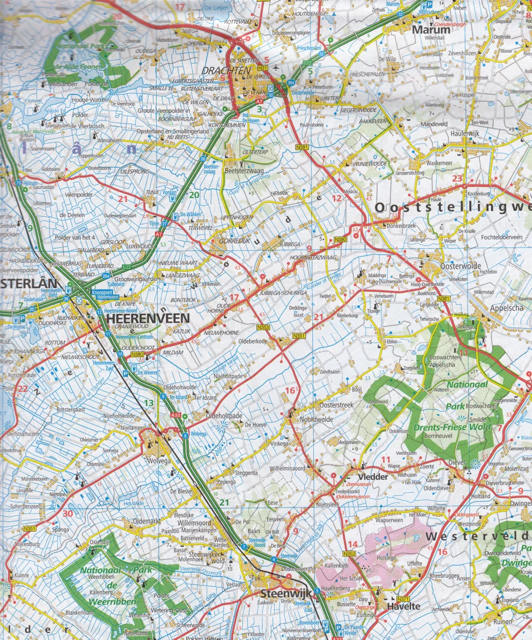
clearly defined road networks
-
ferry routes
-
airports
-
distances in kilometres
-
a detailed place-name index
-
multilingual legend support
It is a map built for real travel use, helping you compare routes, understand regional geography, and plan with confidence.
🌍 Coverage
This map covers:
-
Iceland
-
Faroe Islands
-
Norway
-
Denmark
-
Sweden
-
Finland
-
Estonia
-
Latvia
-
Lithuania
-
Northern Poland
-
Northern Germany
This broad coverage makes it ideal for travellers moving through multiple countries or wanting a bigger-picture view of Northern Europe.
🏙️ Included City Maps
For added practical value, this edition includes inset maps of major northern European capitals and cities, including:
-
Helsinki
-
Copenhagen
-
Oslo
-
Reykjavik
-
Riga
-
Stockholm
-
Tallinn
-
Vilnius
-
Minsk
These inset maps make it easier to orient yourself in key arrival or transit points while travelling.
✨ Features & Benefits
-
Folded format for easy packing and use on the road
-
1:2,000,000 scale ideal for regional planning
-
Comprehensive place-name index
-
Distances shown in kilometres
-
Multilingual legend
-
Roads, ferries, airports, and regional travel detail
-
City inset maps for major northern centres
-
Excellent for independent travel planning across multiple countries
📐 Specifications
| Feature | Detail |
|---|---|
| Title | Northern Europe - Scandinavia, Baltic Countries Road Map |
| Publisher | Freytag & Berndt |
| Format | Folded road map |
| Scale | 1:2,000,000 |
| ISBN-13 | 9783707921892 |
| ISBN-10 | 3707921891 |
| Unfolded Size | Approx. 86 x 107 cm |
| Folded Size | Approx. 25.6 x 13 x 0.8 cm |
| Weight | Approx. 103–110 g |
| Language | Multilingual legend |
| Coverage | Scandinavia, Iceland, Faroe Islands, Baltic States, northern Poland, northern Germany |
| City Insets | Helsinki, Copenhagen, Oslo, Reykjavik, Riga, Stockholm, Tallinn, Vilnius, Minsk |
🎁 Perfect For
-
Independent travellers
-
Road-trippers and campervan travellers
-
Scandinavia and Baltic itinerary planners
-
Travel lovers exploring Northern Europe
-
Anyone wanting a practical regional overview map
Why You’ll Love It
This is the kind of map that makes big-picture travel planning easy. It lets you see the whole region clearly, compare countries and travel routes, and understand how roads, ferries, and cities connect across Northern Europe.
For travellers heading through the Nordic and Baltic world, it is an indispensable planning tool and a dependable companion on the road.

Details & Craftsmanship
Every detail has been carefully considered to bring you the perfect product.
Description
Northern Europe Freytag & Berndt Map
Scale 1:2,000,000 | Folded Road Map | ISBN 9783707921892 | Scandinavia & Baltic Region
The Northern Europe Freytag & Berndt Map is an exceptional regional travel map for anyone planning to explore Scandinavia, the Baltic region, and the wider north of Europe. Clear, practical, and beautifully designed, it offers the kind of broad overview that is perfect for planning long-distance road trips, ferry journeys, and multi-country itineraries.
Covering Iceland, the Faroe Islands, Norway, Denmark, Sweden, Finland, Estonia, Latvia, Lithuania, northern Poland, and northern Germany, this folded map is ideal for independent travellers who want to understand how the region connects by road, sea, and major transport routes. At 1:2,000,000 scale, it strikes an excellent balance between detail and readability, making it a reliable planning tool for journeys across one of Europe’s most rewarding travel regions.
🗺️ Why This Map Stands Out
Broad Northern Europe Coverage
This map offers a truly useful overview of the wider northern European region, helping travellers visualise connections between Scandinavia, the Baltic countries, and nearby mainland Europe.
Ideal for Long-Distance Travel Planning
Designed for regional route planning rather than turn-by-turn local navigation, it is especially well suited to:
-
self-drive holidays
-
campervan and motorhome travel
-
cross-border touring
-
ferry-linked itineraries
-
broader trip planning across the Nordic and Baltic world
Clear and Practical Cartography
Freytag & Berndt maps are known for their readable, user-friendly layout, and this edition includes:
-
clearly defined road networks
-
ferry routes
-
airports
-
distances in kilometres
-
a detailed place-name index
-
multilingual legend support
It is a map built for real travel use, helping you compare routes, understand regional geography, and plan with confidence.
🌍 Coverage
This map covers:
-
Iceland
-
Faroe Islands
-
Norway
-
Denmark
-
Sweden
-
Finland
-
Estonia
-
Latvia
-
Lithuania
-
Northern Poland
-
Northern Germany
This broad coverage makes it ideal for travellers moving through multiple countries or wanting a bigger-picture view of Northern Europe.
🏙️ Included City Maps
For added practical value, this edition includes inset maps of major northern European capitals and cities, including:
-
Helsinki
-
Copenhagen
-
Oslo
-
Reykjavik
-
Riga
-
Stockholm
-
Tallinn
-
Vilnius
-
Minsk
These inset maps make it easier to orient yourself in key arrival or transit points while travelling.
✨ Features & Benefits
-
Folded format for easy packing and use on the road
-
1:2,000,000 scale ideal for regional planning
-
Comprehensive place-name index
-
Distances shown in kilometres
-
Multilingual legend
-
Roads, ferries, airports, and regional travel detail
-
City inset maps for major northern centres
-
Excellent for independent travel planning across multiple countries
📐 Specifications
| Feature | Detail |
|---|---|
| Title | Northern Europe - Scandinavia, Baltic Countries Road Map |
| Publisher | Freytag & Berndt |
| Format | Folded road map |
| Scale | 1:2,000,000 |
| ISBN-13 | 9783707921892 |
| ISBN-10 | 3707921891 |
| Unfolded Size | Approx. 86 x 107 cm |
| Folded Size | Approx. 25.6 x 13 x 0.8 cm |
| Weight | Approx. 103–110 g |
| Language | Multilingual legend |
| Coverage | Scandinavia, Iceland, Faroe Islands, Baltic States, northern Poland, northern Germany |
| City Insets | Helsinki, Copenhagen, Oslo, Reykjavik, Riga, Stockholm, Tallinn, Vilnius, Minsk |
🎁 Perfect For
-
Independent travellers
-
Road-trippers and campervan travellers
-
Scandinavia and Baltic itinerary planners
-
Travel lovers exploring Northern Europe
-
Anyone wanting a practical regional overview map
Why You’ll Love It
This is the kind of map that makes big-picture travel planning easy. It lets you see the whole region clearly, compare countries and travel routes, and understand how roads, ferries, and cities connect across Northern Europe.
For travellers heading through the Nordic and Baltic world, it is an indispensable planning tool and a dependable companion on the road.