Original: $20.82
-65%$20.82
$7.29The Story
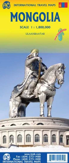
Mongolia Gizi Maps Folded Single-Sided Regional Map
Scale 1:2,000,000 | 1000 mm x 930 mm | Folded Travel Map | Premium Detail
Explore one of the world’s most remote and captivating countries with the Mongolia Gizi Maps Folded Regional Map — a clear, practical, and highly detailed travel companion for independent travellers, overland adventurers, and anyone planning to discover Mongolia beyond the usual routes.
Produced by Gizi Maps, this beautifully designed single-sided regional map offers a broad and informative view of Mongolia’s immense landscapes, from the open steppe and vast desert regions to major towns, transport routes, protected areas, and key places of interest. It is a map designed for real travel: reliable, easy to read, and refreshingly independent of mobile signal, batteries, or internet access.
🗺️ Why This Map Stands Out
Exceptional Countrywide Coverage
Mongolia is one of the least densely populated countries on Earth, and travelling through it often means covering long distances across remote and sparsely serviced regions. This map gives you the wide-angle perspective needed to understand the country as a whole, helping you plan with confidence whether you are heading to Ulaanbaatar, the Gobi, the northern lake country, or the western mountain regions.
Designed for Overland Travel
This is an especially strong map for:
-
self-drive travellers
-
motorbike and 4WD expeditions
-
tour groups and adventure travellers
-
independent explorers venturing beyond the main cities
Its clear road detail includes major routes and many minor tracks, helping travellers visualise journey options across Mongolia’s challenging and often isolated terrain.
Clear and Practical Cartography
Gizi Maps are well known for their traveller-friendly design, and this Mongolia edition is no exception. The map uses:
-
clean colour coding
-
easy-to-read symbols
-
clear topographic presentation
-
useful route and place-name visibility
The result is a map that feels manageable and informative even in a country where distances are huge and infrastructure can be limited.
🌏 What the Map Shows
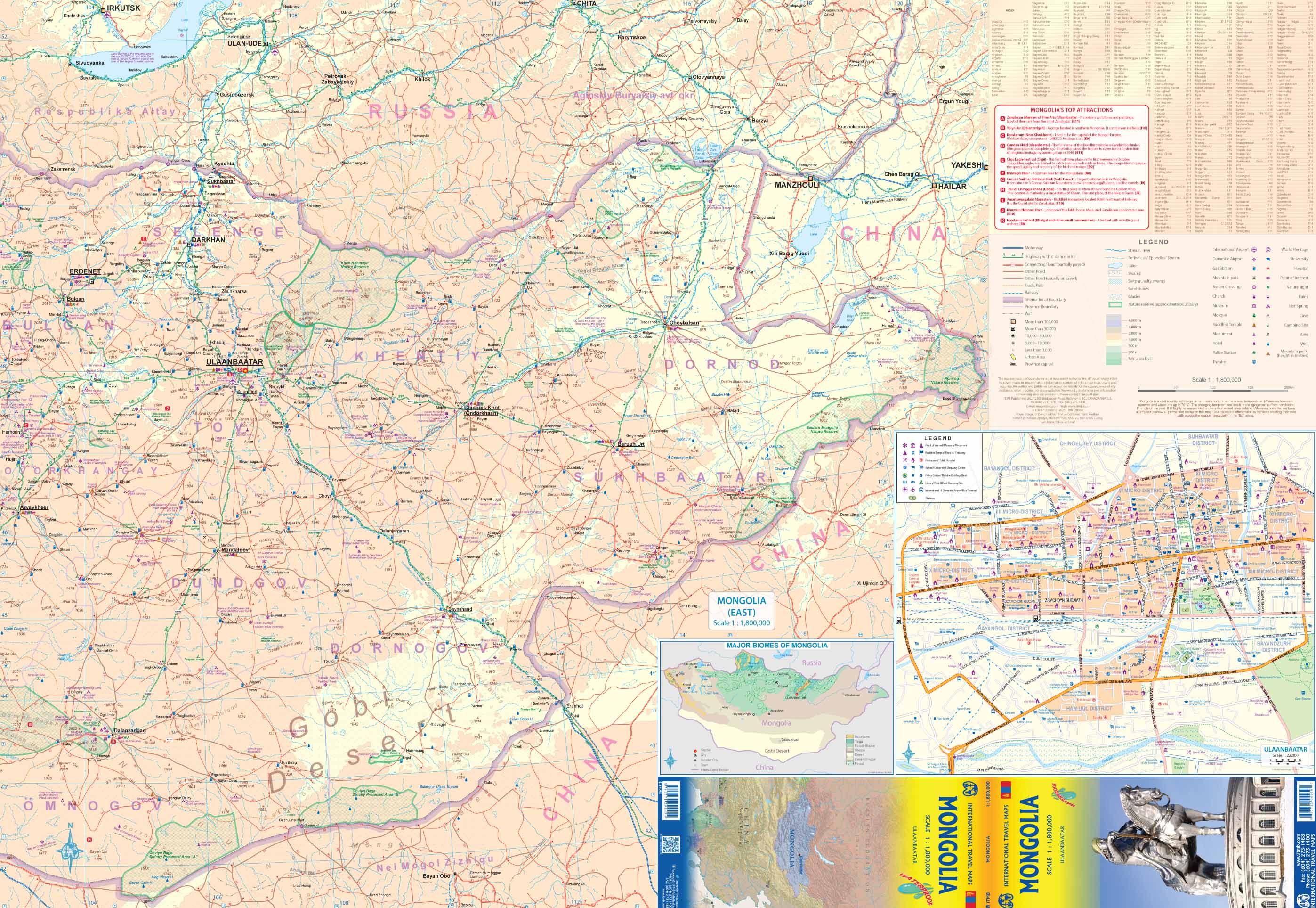
This folded Mongolia map includes:
-
Major cities and towns
-
Roads and many minor tracks
-
National parks and protected areas
-
Tourist attractions and places of interest
-
Airports
-
Border crossings
-
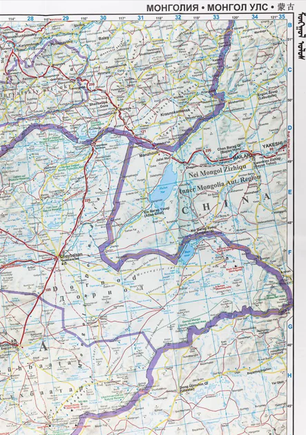
Terrain detail with elevation tinting and spot heights
-
Intermediate road distances on major roads
-
A street plan of central Ulaanbaatar
It also includes names of larger towns in both Cyrillic and Roman script, which makes navigation easier for international travellers.
🧭 Built for Independent Exploration
One of the real strengths of this map is its suitability for travellers who want to move independently through Mongolia. In a country where digital navigation is not always reliable and mobile coverage can be patchy, a well-designed physical map remains one of the most useful tools you can carry.
The folded format makes it easy to pack into:
-
a backpack
-
day bag
-
glovebox
-
travel folder
It is practical, durable, and always ready to use.
✨ Key Features
-
Single-sided regional map
-
Scale: 1:2,000,000
-
Large unfolded size for easy reading
-
Folded format for portability
-
Topographic colouring and terrain detail
-
Useful for long-distance and off-the-main-route travel
-
Includes Ulaanbaatar city centre inset
-
Multilingual legend
-
Excellent for self-guided travel planning
📐 Specifications
| Feature | Detail |
|---|---|
| Title | Mongolia Gizi Maps Folded Regional Map |
| Publisher | Gizi Maps |
| Format | Folded, single-sided |
| Scale | 1:2,000,000 |
| Size | 1000 mm x 930 mm |
| Coverage | Mongolia |
| Map Style | Regional road and travel map |
| Language Notes | Larger town names in Cyrillic and Roman script |
| Inset | Central Ulaanbaatar |
🎁 Perfect For
-
Overland travellers
-
4WD and motorbike adventurers
-
Backpackers and independent explorers
-
Travel planners
-
Geography lovers
-
Anyone preparing for a Mongolia journey
Why You’ll Love It
This is the kind of map that makes travel feel more real. It helps you understand the scale of Mongolia, see where routes lead, and appreciate how extraordinary the country’s geography really is. It is practical enough to use every day on the road, but detailed and attractive enough to keep long after the journey is over.
For travellers who want to explore Mongolia with confidence, curiosity, and independence, this map is an indispensable companion.

Details & Craftsmanship
Every detail has been carefully considered to bring you the perfect product.

Details & Craftsmanship
Every detail has been carefully considered to bring you the perfect product.
Details & Craftsmanship
Every detail has been carefully considered to bring you the perfect product.
Description
Mongolia Gizi Maps Folded Single-Sided Regional Map
Scale 1:2,000,000 | 1000 mm x 930 mm | Folded Travel Map | Premium Detail
Explore one of the world’s most remote and captivating countries with the Mongolia Gizi Maps Folded Regional Map — a clear, practical, and highly detailed travel companion for independent travellers, overland adventurers, and anyone planning to discover Mongolia beyond the usual routes.
Produced by Gizi Maps, this beautifully designed single-sided regional map offers a broad and informative view of Mongolia’s immense landscapes, from the open steppe and vast desert regions to major towns, transport routes, protected areas, and key places of interest. It is a map designed for real travel: reliable, easy to read, and refreshingly independent of mobile signal, batteries, or internet access.
🗺️ Why This Map Stands Out
Exceptional Countrywide Coverage
Mongolia is one of the least densely populated countries on Earth, and travelling through it often means covering long distances across remote and sparsely serviced regions. This map gives you the wide-angle perspective needed to understand the country as a whole, helping you plan with confidence whether you are heading to Ulaanbaatar, the Gobi, the northern lake country, or the western mountain regions.
Designed for Overland Travel
This is an especially strong map for:
-
self-drive travellers
-
motorbike and 4WD expeditions
-
tour groups and adventure travellers
-
independent explorers venturing beyond the main cities
Its clear road detail includes major routes and many minor tracks, helping travellers visualise journey options across Mongolia’s challenging and often isolated terrain.
Clear and Practical Cartography
Gizi Maps are well known for their traveller-friendly design, and this Mongolia edition is no exception. The map uses:
-
clean colour coding
-
easy-to-read symbols
-
clear topographic presentation
-
useful route and place-name visibility
The result is a map that feels manageable and informative even in a country where distances are huge and infrastructure can be limited.
🌏 What the Map Shows
This folded Mongolia map includes:
-
Major cities and towns
-
Roads and many minor tracks
-
National parks and protected areas
-
Tourist attractions and places of interest
-
Airports
-
Border crossings
-
Terrain detail with elevation tinting and spot heights
-
Intermediate road distances on major roads
-
A street plan of central Ulaanbaatar
It also includes names of larger towns in both Cyrillic and Roman script, which makes navigation easier for international travellers.
🧭 Built for Independent Exploration
One of the real strengths of this map is its suitability for travellers who want to move independently through Mongolia. In a country where digital navigation is not always reliable and mobile coverage can be patchy, a well-designed physical map remains one of the most useful tools you can carry.
The folded format makes it easy to pack into:
-
a backpack
-
day bag
-
glovebox
-
travel folder
It is practical, durable, and always ready to use.
✨ Key Features
-
Single-sided regional map
-
Scale: 1:2,000,000
-
Large unfolded size for easy reading
-
Folded format for portability
-
Topographic colouring and terrain detail
-
Useful for long-distance and off-the-main-route travel
-
Includes Ulaanbaatar city centre inset
-
Multilingual legend
-
Excellent for self-guided travel planning
📐 Specifications
| Feature | Detail |
|---|---|
| Title | Mongolia Gizi Maps Folded Regional Map |
| Publisher | Gizi Maps |
| Format | Folded, single-sided |
| Scale | 1:2,000,000 |
| Size | 1000 mm x 930 mm |
| Coverage | Mongolia |
| Map Style | Regional road and travel map |
| Language Notes | Larger town names in Cyrillic and Roman script |
| Inset | Central Ulaanbaatar |
🎁 Perfect For
-
Overland travellers
-
4WD and motorbike adventurers
-
Backpackers and independent explorers
-
Travel planners
-
Geography lovers
-
Anyone preparing for a Mongolia journey
Why You’ll Love It
This is the kind of map that makes travel feel more real. It helps you understand the scale of Mongolia, see where routes lead, and appreciate how extraordinary the country’s geography really is. It is practical enough to use every day on the road, but detailed and attractive enough to keep long after the journey is over.
For travellers who want to explore Mongolia with confidence, curiosity, and independence, this map is an indispensable companion.