The Story
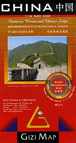
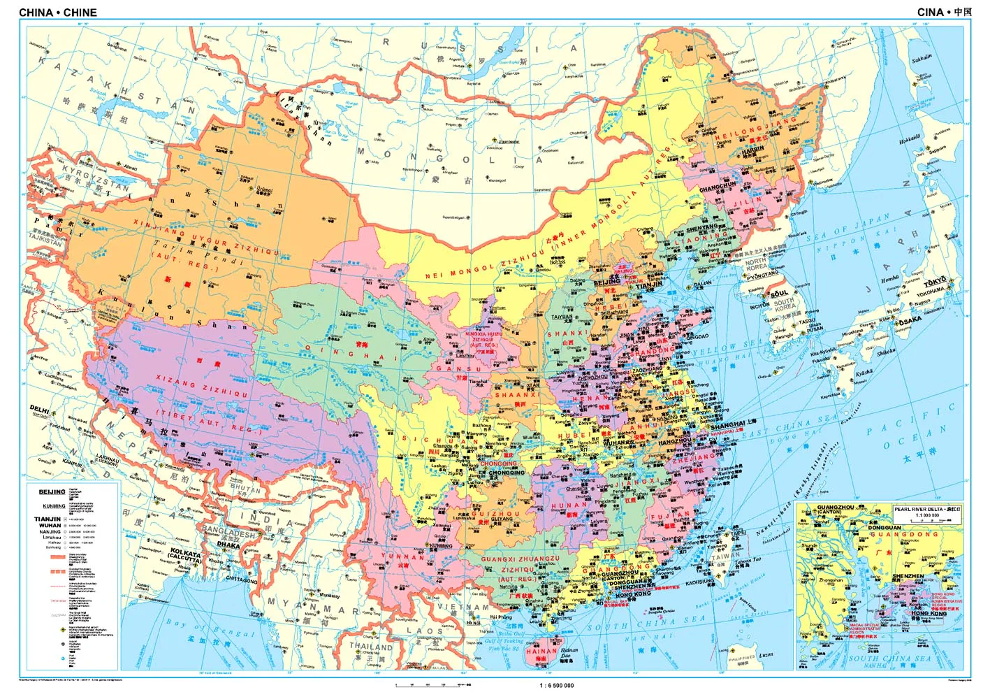
High-level political map of China | Single-sided | Scale 1:6,500,000 | Size: 1000 mm x 930 mm
This beautifully designed folded political map of China by Gizi Maps offers a clear and comprehensive overview of the country’s administrative divisions and key infrastructure. Ideal for students, educators, business professionals, or anyone seeking a visual understanding of China's vast provincial structure, this map presents the entire country in a single, colour-coded view.
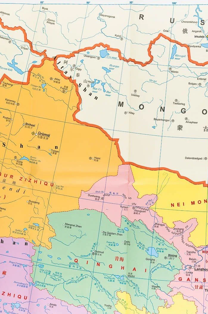
Each province is shaded in a distinct colour, making borders and jurisdictions easy to identify at a glance. Perfect for classrooms, boardrooms, or travel reference, this map is as informative as it is visually appealing.
🧭 Key Features:
-
Scale 1:6,500,000 – A balanced scale offering broad national coverage with clear readability
-
Colour-coded provinces – Distinct colours delineate all provinces, autonomous regions, and municipalities
-
Major cities and capitals clearly labeled for quick orientation
-
Political boundaries for provinces, prefectures, and national borders
-
Inset of the Pearl River Delta, one of China’s most economically vital regions
-
Great Wall of China route highlighted for historical context
-
Transport infrastructure including:
-
Major airports, ports, and waterways
-
Key national roadways and rail lines
-
-
Multilingual legend in English, German, French, Italian, and Chinese
-
Printed on high-quality map stock for durability and clarity
📐 Map Specifications
| Feature | Description |
|---|---|
| Publisher | Gizi Maps |
| Coverage | Entire territory of the People's Republic of China |
| Scale | 1:6,500,000 |
| Format | Folded, single-sided |
| Size | 1000 mm (W) x 930 mm (H) |
| Language | Multilingual legend (5 languages) |
📌 Why Buy This Map?
-
✅ Ideal for educational use in schools, universities, and geography programs
-
✅ Perfect for business and logistics professionals operating across China’s provincial regions
-
✅ Great for wall reference in home offices, classrooms, or planning spaces
-
✅ Visually clear and easy to read – perfect for all ages
-
✅ Inset of the Pearl River Delta makes this particularly useful for economic or trade reference
🛠️ Order On Demand
📦 This is a special Order on Demand item.
🕒 Please allow up to 10 working days for delivery, as maps are ordered from Europe.
Whether you're planning a journey, teaching about China, or simply want a high-quality visual representation of the world’s most populous nation, this Gizi Political Map of China delivers outstanding value and clarity.
👉 Add to Cart Today to bring the political landscape of China into focus.
Details & Craftsmanship
Every detail has been carefully considered to bring you the perfect product.
Details & Craftsmanship
Every detail has been carefully considered to bring you the perfect product.
Description
High-level political map of China | Single-sided | Scale 1:6,500,000 | Size: 1000 mm x 930 mm
This beautifully designed folded political map of China by Gizi Maps offers a clear and comprehensive overview of the country’s administrative divisions and key infrastructure. Ideal for students, educators, business professionals, or anyone seeking a visual understanding of China's vast provincial structure, this map presents the entire country in a single, colour-coded view.
Each province is shaded in a distinct colour, making borders and jurisdictions easy to identify at a glance. Perfect for classrooms, boardrooms, or travel reference, this map is as informative as it is visually appealing.
🧭 Key Features:
-
Scale 1:6,500,000 – A balanced scale offering broad national coverage with clear readability
-
Colour-coded provinces – Distinct colours delineate all provinces, autonomous regions, and municipalities
-
Major cities and capitals clearly labeled for quick orientation
-
Political boundaries for provinces, prefectures, and national borders
-
Inset of the Pearl River Delta, one of China’s most economically vital regions
-
Great Wall of China route highlighted for historical context
-
Transport infrastructure including:
-
Major airports, ports, and waterways
-
Key national roadways and rail lines
-
-
Multilingual legend in English, German, French, Italian, and Chinese
-
Printed on high-quality map stock for durability and clarity
📐 Map Specifications
| Feature | Description |
|---|---|
| Publisher | Gizi Maps |
| Coverage | Entire territory of the People's Republic of China |
| Scale | 1:6,500,000 |
| Format | Folded, single-sided |
| Size | 1000 mm (W) x 930 mm (H) |
| Language | Multilingual legend (5 languages) |
📌 Why Buy This Map?
-
✅ Ideal for educational use in schools, universities, and geography programs
-
✅ Perfect for business and logistics professionals operating across China’s provincial regions
-
✅ Great for wall reference in home offices, classrooms, or planning spaces
-
✅ Visually clear and easy to read – perfect for all ages
-
✅ Inset of the Pearl River Delta makes this particularly useful for economic or trade reference
🛠️ Order On Demand
📦 This is a special Order on Demand item.
🕒 Please allow up to 10 working days for delivery, as maps are ordered from Europe.
Whether you're planning a journey, teaching about China, or simply want a high-quality visual representation of the world’s most populous nation, this Gizi Political Map of China delivers outstanding value and clarity.
👉 Add to Cart Today to bring the political landscape of China into focus.